Reading a GSI map
Japanese topographic map symbols (地理院地図) useful for hiking, explained in English with excerpts from the maps of our hikes.
All the maps on this site come from the GSI, the Geospatial Information Authority of Japan (国土地理院, Kokudo Chiriin). Their standard 1:25,000 map shows contour lines, huts, trails and vegetation in detail. Its labels are in Japanese, and its symbols may differ from those on maps you are used to. The symbols below are useful in the mountains, with examples taken from the maps of our own hikes.
Landmarks and elevations
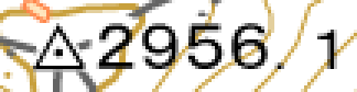
Triangulation point 三角点 sankakuten
A square granite marker whose position and elevation are precisely surveyed; the elevation is given to the decimeter (here 2,956.1 m, on Kiso-Komagatake). It is often at or very near the summit and is an excellent landmark for checking your position.
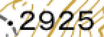
Spot height 標高点 hyōkōten
A simple dot showing the elevation to the nearest meter, with no marker on the ground: a secondary summit, a pass or a shoulder.
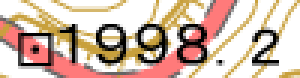
Benchmark 水準点 suijunten
A square with a dot, usually beside a road. Like the triangulation point, it corresponds to a real marker.

Contour lines 等高線 tōkōsen
One line every 10 m; every fifth line is thicker and labeled with its elevation (here 2,050 m). The closer the lines are, the steeper the slope.
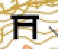
Shintō shrine 鳥居 torii
The torii gate marks a shrine (神社, jinja). Many mountain summits are sacred and have a small shrine: you can see it on the maps of Kiso-Komagatake or Ontake. It does not mark the 100 Famous Mountains, which the GSI map does not show, even though the two often coincide.
Paths and buildings

Trail 徒歩道 tohodō
The dashed gray line: a path less than 1.5 m wide. The line may be old or approximate; before setting out, it is best to check trail conditions on YamaReco or YAMAP.
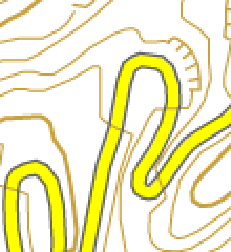
Road 道路 dōro
Main roads are in color (yellow, red) edged with gray; small roads and forest tracks are plain gray lines. In the mountains, the road often ends at the trailhead (登山口, tozanguchi).
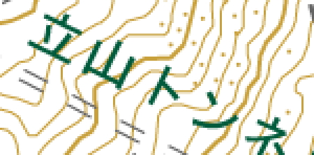
Tunnel トンネル tonneru
Two thin, parallel dashed lines: the road or railway passes under the mountain (here the Tateyama tunnel, under Murodō).
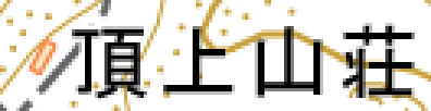
Building, hut 建物 tatemono
The small orange rectangles are buildings. At altitude, these are the huts: their names end in 山荘 (sansō), 小屋 (koya or goya) or 荘 (sō). Here the Chōjō-sansō hut, at the summit of Kiso-Komagatake.
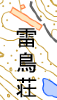
Hut and its name 山荘 sansō
The hut’s name is written next to it, sometimes vertically, as here with Raichō-sō (雷鳥荘) near Murodō. Being able to read it in Japanese helps you recognize signs along the trail.
Water and volcanoes
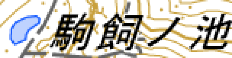
Pond, lake 池 ike
Shown in blue, with a name ending in 池 (ike), 沼 (numa) or 湖 (ko). A pond beside the trail is a good landmark.
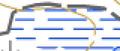
Wetland 湿地 shitchi
Small horizontal blue dashes: a bog or wet meadow, often crossed by a boardwalk.
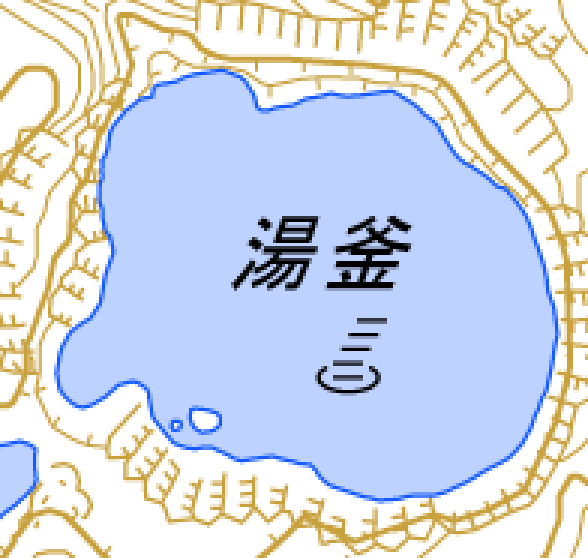
Crater lake 火口湖 kakōko
Lake Yugama (湯釜) on Kusatsu-Shirane, surrounded by a crater rim shown with hachures. These areas are often closed when there is volcanic activity.
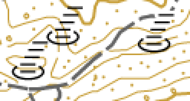
Crater, fumarole 噴火口・噴気口 funkakō, funkikō
This symbol marks a crater or a fumarole venting volcanic gas, here in the Jigokudani (“hell valley”) of Murodō. Sulfurous gases are dangerous: stay on the marked trails and follow local closures.
Terrain and vegetation

Cliff 崖 gake
Comb-like ticks along a line indicate a cliff or a steep bank (earth or rock). The trail goes around these features; on the way down, in fog, this is the symbol to watch for.

Sand and gravel 砂礫地 sarekichi
Scattered dots: scree, gravel, volcanic sand. Very common above the tree line in the Japanese Alps.

Grass and scrub 荒地 arechi
Small vertical ticks: grass and low shrubs, with open views.
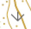
Creeping pine ハイマツ地 haimatsu-chi
A small downward-pointing arrow: the dwarf pine haimatsu, which covers the ridges above the tree line, at about 2,400 – 2,500 m in the Northern Alps. This is exposed ground: watch out for wind and thunderstorms.

Conifer forest 針葉樹林 shin'yōju-rin
The “Λ”: Japanese cedars, cypresses, larches, firs. These are often plantations in the valleys and natural forests higher up.

Broadleaf forest 広葉樹林 kōyōju-rin
The slanted “q”: beeches, oaks and maples, the trees that provide autumn colors (紅葉, kōyō).
Map and compass
The GSI map is oriented to true north, but the compass needle points about 8° further west in the regions of our hikes. The Print the map button on each hike adds magnetic-north lines, calculated with the World Magnetic Model (WMM 2025) for the area of the track: just line the compass up with them.
Further reading
- Reading “GSI” Topographic Maps, the English guide by RidgelineImages, with photos of each type of terrain, which inspired this page.
- 地図記号 on Wikipedia (in Japanese), the complete list of symbols.
- 地理院地図, the GSI online map, and its help page.
The map excerpts come from the GSI tiles (地理院タイル), enlarged to three times their original size without retouching.