Kamikochi – Karasawa Hütte
涸沢

From the pebbles of the Azusa to the snow
View 4 photos- Distance
- 18.2km
- Ascent
- 820m
- 32 m of descent
- Walking time
- 5 h 34
- 8 h 55 with breaks
- High point
- 2,308m
- low point 1,517 m
- Season
- Spring
- May 2007
From Kamikochi to the snowy cirque
We leave Kamikochi in the morning, passing Kappa-bashi and the Takezawa marsh. The Azusa valley leads to Myōjin, Tokusawa and then Yokoo-Sansō. Beyond it, the trail climbs through snow to Karasawa Hütte, which we reach at about 15:30.

Nights in huts
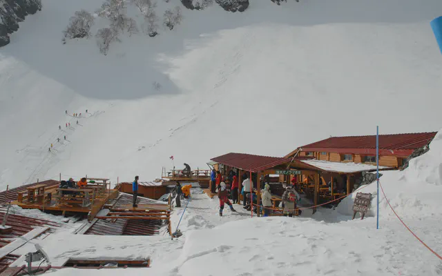 Karasawa Hütte 涸沢ヒュッテ

From the GPS tracks: where they stop in the evening and start again in the morning.
Before you return
Today’s trail conditions and recent trip reports:
Map and profile
Download the GPX track
How to read this map
Hover over the profile to follow the track on the map. The thumbnails show where each photo was taken; click one to enlarge it.
Photos 4


